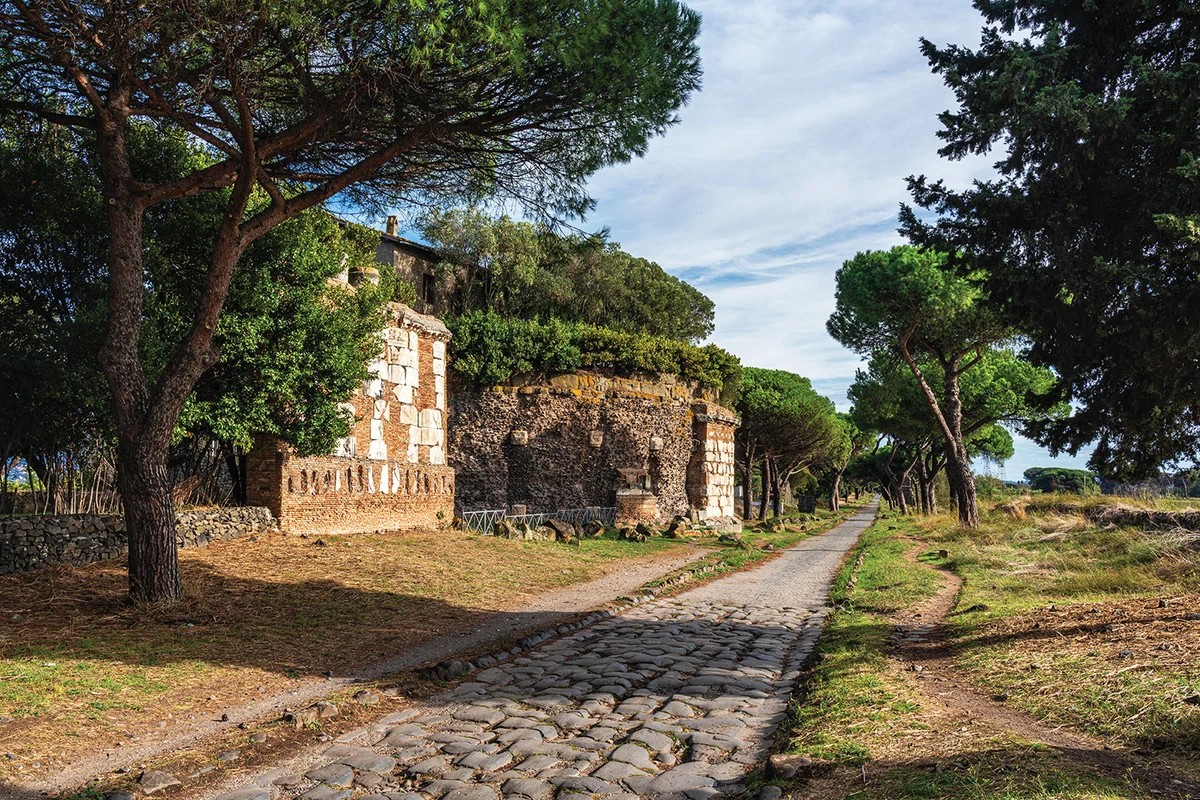
Walking the Via Appia feels like slipping through a tear in time. Past Seneca’s old house, past the cypresses that still guard the way, I felt the weight of history pressing in. Built in 312 BCE to march troops to Brindisi, it is the oldest famous road of the Empire.
Scholars call it the queen. A straight shot of volcanic stone. Straight as an arrow.
It isn’t the archetype. Not really. My team and I mapped it all. High resolution. Open access. Single resource.
What we saw changed everything.
“The road system that undergired this superpower looks nothing like the straight lines we were taught.”
We spent centuries finding bits. Milestones. Crumbling pavers. Texts mentioning a road from Town A to Town B. Piecing it together gave us a fuzzy blob. A low-res guess.
We needed precision. To understand how they fed people. How they moved armies. How they linked Egypt to Germany, Spain to Turkey, for the first time in human history, a network this large flowed with ideas, goods, and disease.
We thought it would be easy. Connect the dots from 200 years of research.
Wrong.
The Numbers Are Shattering
In the second century CE, at its peak, the road network covered 300,000 km.
That’s double the previous estimate.
Here’s the kicker: We know the exact location of only 2.7% of it. The rest is ghosts. How can we be this lost after all this time?
Romans didn’t invent the road. The Persians had the Royal Road. The Greeks had networks. The Babylonians too.
The Romans just scaled it. They stitched together local paths into the first continental grid.
And they didn’t all go to Rome.
Trajan built the Via Nova Traiana in the east. From Aqaba on the Red Sea to Bosra in Syria. It didn’t touch Rome. It secured the desert. The Limes Arabicus stretched 1,500 km—way bigger than Hadrian’s Wall in Britain. Defense required connectivity that ignored the capital.
Milestones were propaganda. “I built this,” Augustus would write on a stone in Spain. Via Augusta. Cádiz to the Pyrenees. Tying Iberia to the core.
But these stones also gave us coordinates. Mille passus. A thousand paces. 5,000 feet. Roughly 1.5 km. They were ancient GPS pins.
Finding The Invisible
We aggregated 8,000 milestones and 14,00 ancient place names. Connect the dots, right?
Most lines are gone.
Samosata. Ancient capital of Commagene. Submerged in the 1983s when the Atatürk Dam flooded it. Gone under meters of water.
We found it anyway. Using declassified Cold War spy satellite photos. Taken before the water rose. The roads were still there, visible from space, frozen in time before the lake swallowed the land.
Cities expand too. Foundations dug up destroy layers.
Sometimes war maps save us. French military surveys from the 1920s show roads in Syria and Lebanon that suburban sprawl now hides. We traced those lines.
We also used topography.
Old maps like the Barrington Atlas are too broad. Scales of 1:500,00? Useless for hiking details.
Look at Greece. Mantinea to Argos. A mountain stands in the way.
The old map draws a curve around it. 62 km. A twenty-hour hike.
Humans are lazy. They cut passes. Zig-zags. Switchbacks.
We mapped those switchbacks. That detail alone added 111,00 km to the total length.
Then there’s the mud. The Rhine delta used to be a wetland maze. The Dutch changed the rivers for war and drainage. We looked at sediment layers. Paleogeography. Reconstructed the Roman-era landscape to find dry ground between islands that no longer exist.
The Uncertainty Principle
Only 8,00 km of road is certain. Visible or excavated. The rest is probability.
Take Spain. Baetica province. Olive oil factories everywhere. Amphora shipments heading to German legions. We have the farms. The presses. The ports.
But zoom in. The landlocked farm? No known road connects it.
There must have been one. Or how did they get to work?
We can’t excavate everywhere. It costs money. It takes time. We focus on points, not lines.
So we mapped the unknowns. A confidence chart. Where we know. Where we guess.
It charts our ignorance.
“We built a map that admits how little we actually see.”
292,00 km rely on conjecture. Historical text here. Logic there.
Maybe we’re right. Maybe we aren’t.
But now we know where to dig. The gaps in the map are the places worth visiting.
The rest stays lost. Or doesn’t.